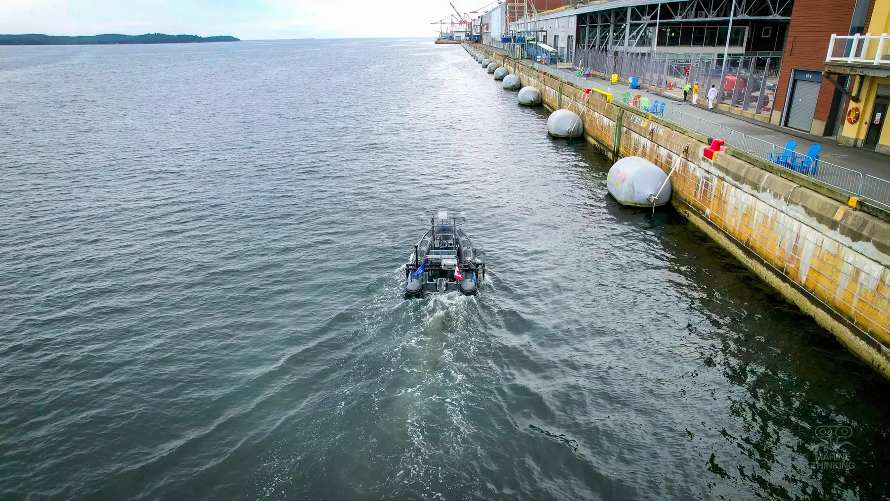
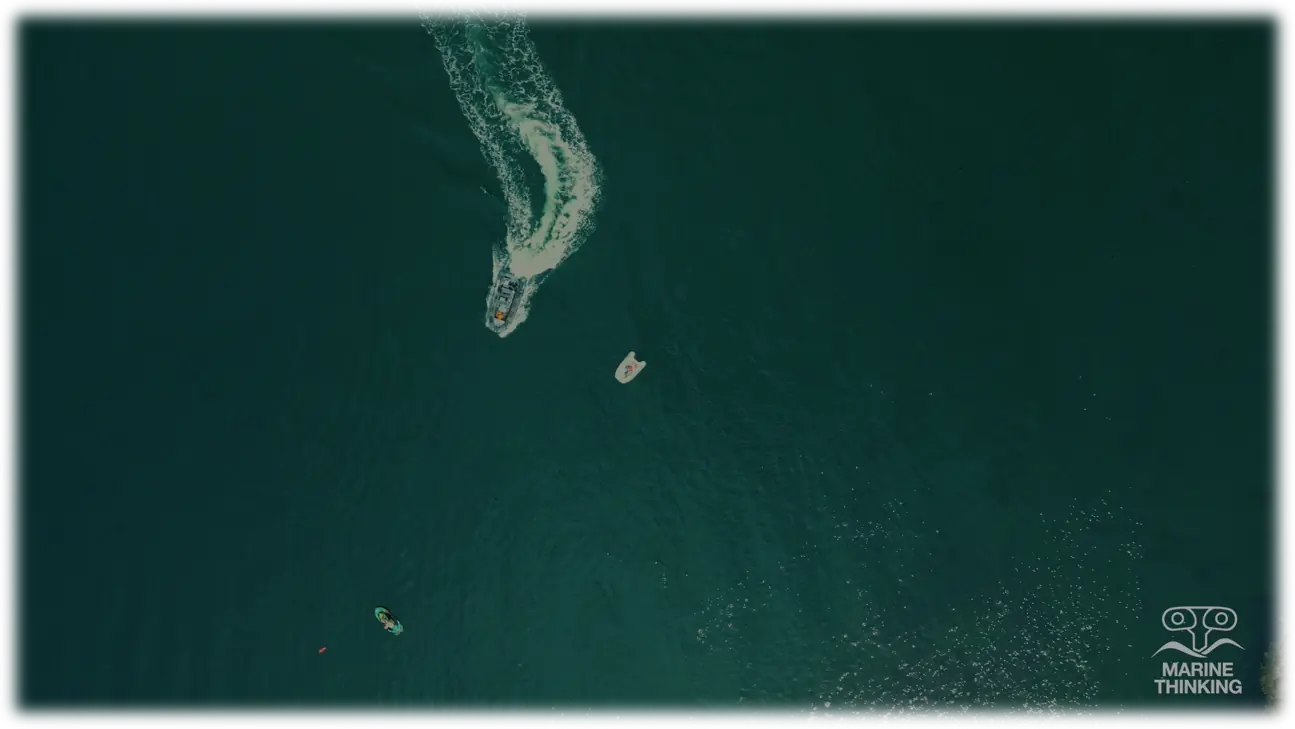
NaviDepth brings survey vessels, measurement payloads and data review together around your operating question. Explore a proposed configuration for seabed surveys and waterway monitoring, with pilot scope, delivery roles and acceptance criteria agreed for each project.
The big picture: from reaction to preventionLocal evidence for safer, healthier and more resilient waterways
Observe · compare · understand · act
Why NaviDepth matters
Understand change before it becomes crisis.
Waterways connect people, infrastructure, livelihoods and nature. Yet many changes beneath and around the water remain invisible until they become costly disruption. NaviDepth exists to close that knowledge gap—making waterways easier to observe, change easier to understand and preventive action easier to take.
Mission
Help waterway communities understand change early enough to act.
By turning repeatable surveys and connected environmental observations into practical evidence, NaviDepth supports safer navigation, preventive maintenance, climate-adaptation planning and healthier freshwater ecosystems.
Vision
Every waterway observed regularly, understood locally and cared for before change becomes crisis.
Our ambition reaches beyond a vessel: build a dependable evidence layer that helps people protect infrastructure, ecosystems and development gains—using technology as a practical means, not an end.
Connected to a wider development agendaBetter waterway intelligence can contribute to clean water, resilient infrastructure, sustainable communities and climate action.
These goals give the project a direction beyond one vessel or one location. They are a compass for the work—not a certification or endorsement.
A practical bridge from local waterway evidence to climate resilience.
NaviDepth’s proposed survey and monitoring approach relates to priorities highlighted in the UNDP Strategic Plan 2026–2029—especially crisis resilience, a healthy planet and digital and AI transformation. Repeatable, locally relevant observations can strengthen risk knowledge, climate-adaptation planning and the evidence for earlier action. Reliable evidence can also help authorities prioritise maintenance and adaptation investment where limited resources can have the greatest impact.
How the vision becomes practicalOne complete ecosystem—or a focused capability for an existing vessel.
Turn repeated observation into earlier, better-informed action.
The value is not automation for its own sake. It is the ability to build a trusted record of the waterway, involve people where their judgement matters most and respond before emerging change becomes avoidable disruption.
Fewer routine field deployments
Remote supervision and repeatable missions can reduce the number of people who must travel to every measurement location.
More frequent measurements
A configured vessel and repeatable workflow make it practical to revisit priority areas more consistently.
A connected mission data flow
When communications permit, vessel, position and sensor data can move from the water to the operator and review workflow without disconnected handovers.
Prediction-ready time series
Comparable repeat measurements can support change detection, maintenance forecasting and predictive models once enough validated data exists.
Human-supervised operation
Defined operating limits, operator oversight and staged acceptance keep technology deployment connected to real waterway conditions.
Lower-impact monitoring
Electric platforms and targeted mobilisation can reduce noise, local emissions and unnecessary travel for suitable missions.
Actual personnel, environmental and operational benefits depend on the route, communications, vessel configuration, survey frequency and agreed operating concept. They are defined and measured during the assessment and pilot.
From project foundation to customer delivery
Clear roles from assessment to vessel pilot.
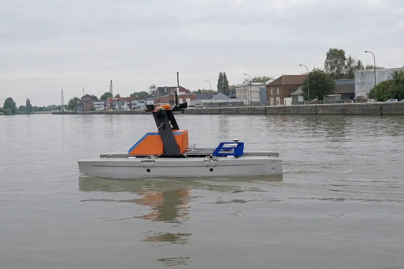
Urban Waterway Logistics (UWL) leads NaviDepth, drawing on AVATAR vessel and remote-operation experience. Marine RoboTech supports requirements assessment and system integration. Equipment, field operations and support responsibilities are agreed for each project.
European customer & project leadUrban Waterway Logistics (UWL)
Operational discovery, European waterway context, stakeholder coordination, pilot framing and one clear customer contact.
Technical assessment & integrationMarine RoboTech
Requirements assessment, equipment selection and system interfaces. Survey, commissioning and local-service specialists are engaged according to the agreed project scope.
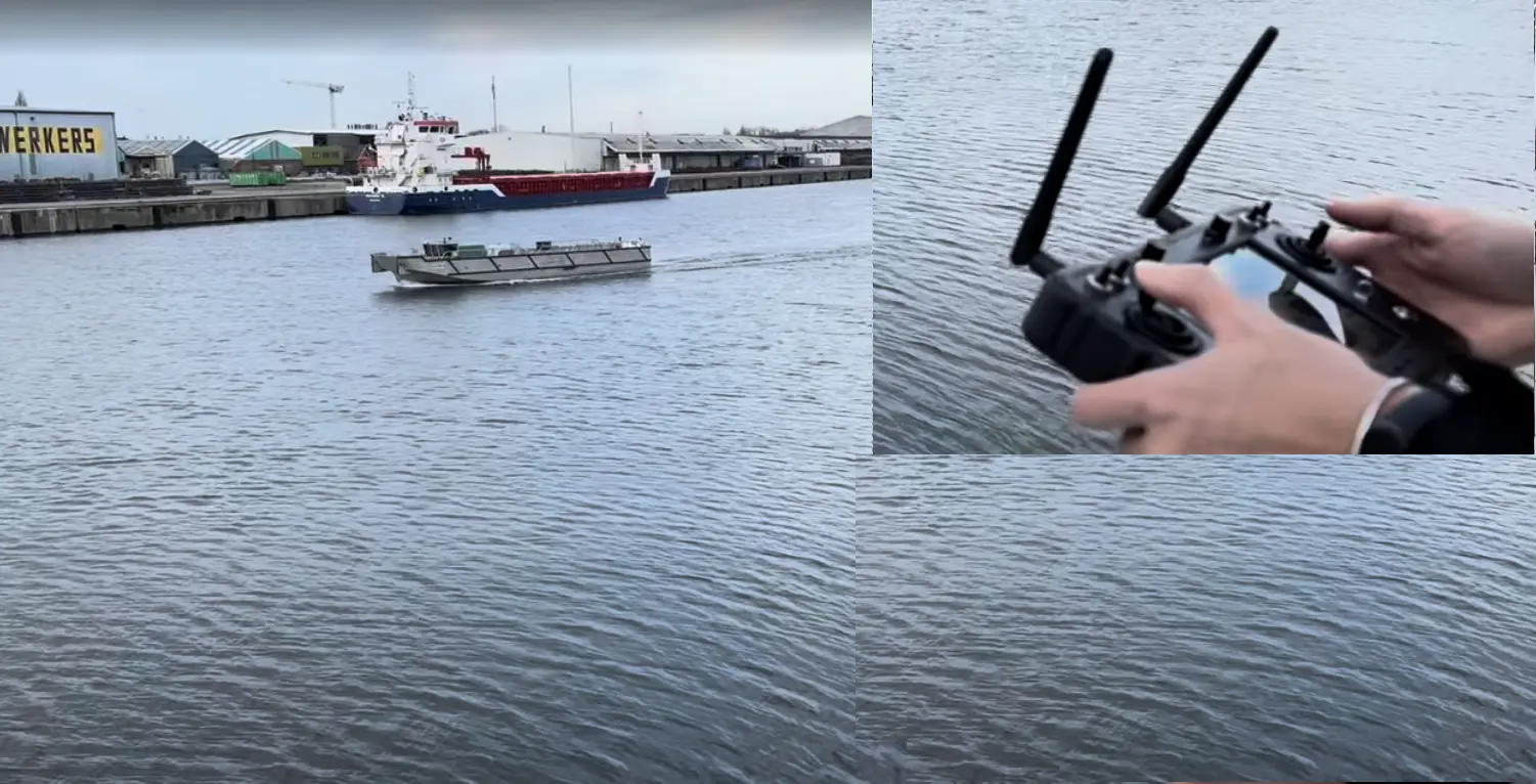
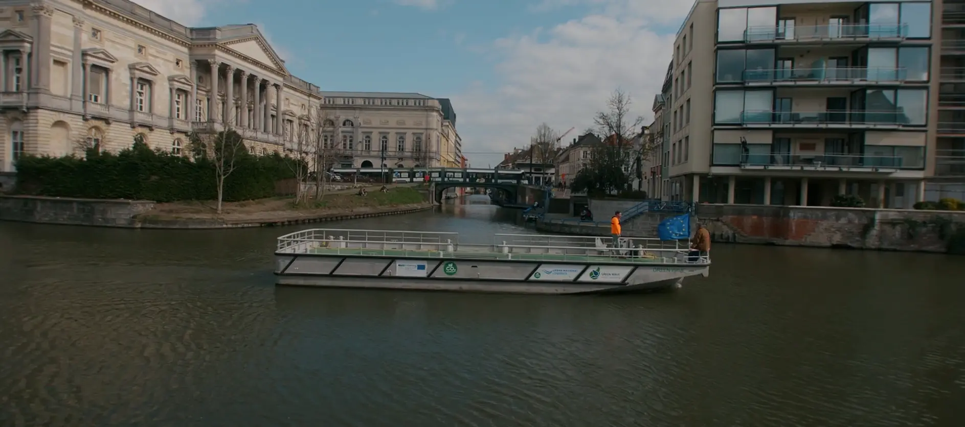
Foundation · AVATAR projectUWL's AVATAR vessel and handheld remote-control testing in Ghent
From monitoring need to customer output
Depth, environmental and vessel data connected in one mission workflow
Mission planning, field acquisition, data processing, review and operational outputs are defined together instead of treated as separate purchases.
Modular by design
Start with the required capability and expand when the operating case is proven
A pilot may begin with survey, remote control or awareness, then add docking, charging, environmental payloads, fleet operation or data integration where justified.
Primary commercial offer
A complete survey-vessel solution—configured around the decision the customer needs to make.
The offer is more than a boat. It connects the mobile platform, measurement payload, control, data workflow and support route required for a repeatable professional mission.
Platform
Vessel & energy
Electric craft, propulsion, batteries and payload capacity selected for the route and mission.
Hull · propulsion · endurance · delivery
Measurement
Survey payload
Bathymetry, positioning, motion sensing and selected environmental instruments.
SBES/MBES · GNSS/RTK · IMU · water quality
Control
Control & communications
Mission planning, remote supervision, vessel status and a defined communications route.
Controller · telemetry · communications · RTK
Operator support
Awareness option
Spatial sensing and operator cues configured for the vessel, site and operating conditions.
LiDAR · cameras · compute · alerts
Customer output
Data & quality workflow
Synchronisation, correction, specialist review where required, maps and system-ready exports.
Processing · QA · bathymetry · reports
Lifecycle
Docking, training & support
Optional docking and charging, commissioning, operator training, spares and service planning.
Docking · charging · training · service
The configured system in practice
Platform, payload and live survey data—connected as one mission.
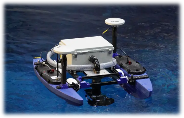
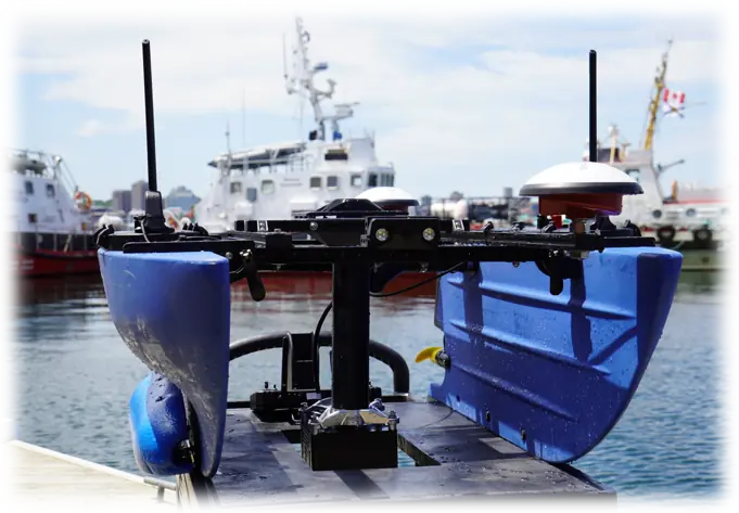
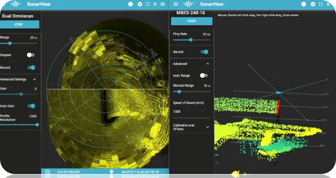
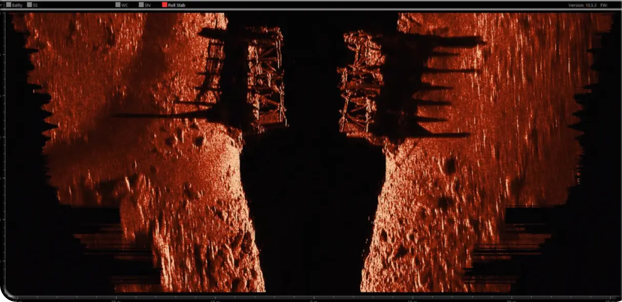
These Marine Thinking technology references show representative vessel and survey components. The customer configuration is selected only after the waterway, output standard and operating conditions are defined.
01 · PlatformCompact hydrographic vesselElectric platform with positioning and configurable survey payload
03 · AcquireLive sonar & 3D viewOperator-facing sensor data during a configured mission
04 · InspectUnderwater structure & seabed imagingExample side-scan output for inspection and survey review
Technology-reference imagery courtesy of Marine Thinking. Final scope, sensors and survey standard are project-specific.
Survey vessel ecosystem
One supervised mission loop. Five connected layers.
Mission planning, operator oversight, field acquisition, quality assurance and customer outputs work as one configurable system.
Mission planning sends instructions to a survey vessel under human supervision. Vessel measurements and telemetry go through processing and quality assurance. Reviewed outputs support customer decisions and inform the next mission. Docking, extra payloads, fleet coordination and customer-platform integration are optional.
01 · Frame
Mission & scope
Translate the operational question into a measurable mission.
Decision, area & route
Frequency & coverage
Output & acceptance standard
02 · Acquire
Vessel & payload
Collect time-aligned position, motion and survey measurements.
Electric platform & energy
GNSS/RTK · IMU
SBES/MBES · optional sensors
03 · Supervise
Operator & control
Keep a human in command with a defined operating envelope.
Mission planning & authorization
Status, telemetry & alerts
Remote control & fallback
04 · Assure
Processing & QA
Turn raw measurements into a traceable, reviewed dataset.
Synchronise & correct
Coverage & anomaly review
Specialist validation as required
Quality gate
05 · Decide
Decision outputs
Deliver information in the form the customer can use.
Bathymetry & change indicators
GIS/CAD/data exports
Reports & agreed integrations
Mission & controlPosition · motion · survey dataReviewed information
Automation level, payload, communications and acceptance criteria are defined and validated for each operating case.
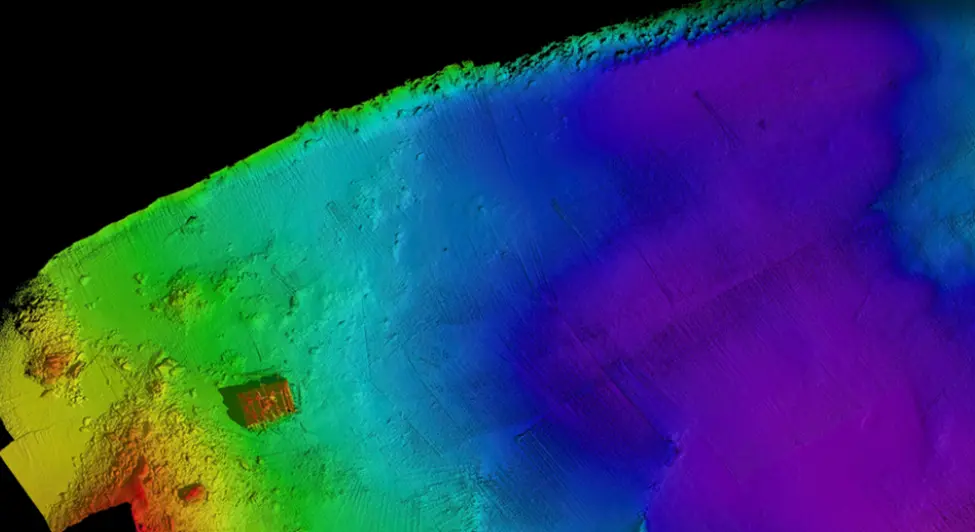
Example reviewed bathymetric surfaceFinal outputs and survey standards are defined for each project.
Survey output
Turn repeatable field missions into reviewed, decision-ready depth data.
Before deployment, we agree the survey standard, calibration, quality checks and acceptance method—so the vessel, payload and workflow are configured around the customer’s decision.
Extend the platform beyond bathymetry when the customer case requires it.
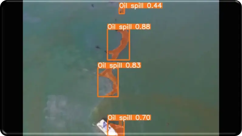
Compatible cameras, environmental instruments and analytics may be configured for targeted monitoring tasks. This surface-anomaly example illustrates a possible application direction; sensor selection, model performance and alert thresholds require separate site validation.
Surface-anomaly screening · illustrative technology example
Remote operations & operator support
Add the capability you need—from vessel control to a portable shore station.
Each product begins with a vessel-interface, communications and operating-risk assessment. The systems are configured around the craft and mission—not presented as universal plug-and-play boxes.
Standalone product 01
Remote Control Kit
A vessel-specific package for supervised command, telemetry and communications. Optional RTK positioning and mission functions are included only when they fit the operating case and vessel interface.
01Interface assessmentSteering, propulsion, power, safety and communications
02Software & hardware integrationOnboard gateway, controller, telemetry and agreed functions
03On-site installationScheduled around vessel access and installation readiness
04Commissioning & tuningSupervised field tests, parameters, training and acceptance
Standalone product 02
Mobile Remote Operations Center
Configurable concept · first pilot to be validated
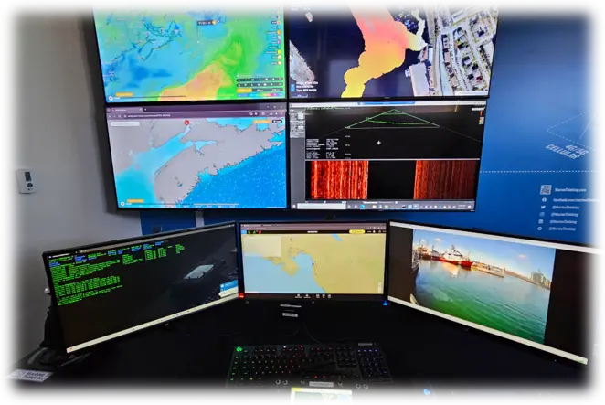
A transportable operator environment for demonstrations, training and supervised pilots. The workstation brings selected camera, navigation, telemetry, communications and alert views together at shore.
Portable formatRugged flight cases or a compact workstation selected for the deployment
Common operating viewVessel video, status, position, alarms and mission information
Defined oversightOperator roles, communications checks and stop/abort procedures
Scalable architectureA mobile demonstrator can inform a later fixed or multi-vessel center
Representative operator workstation · mobile enclosure and interfaces are project-specific
Onboard perception · standalone or part of NaviDepth
Marine Awareness
A clearer view of what is around your vessel.
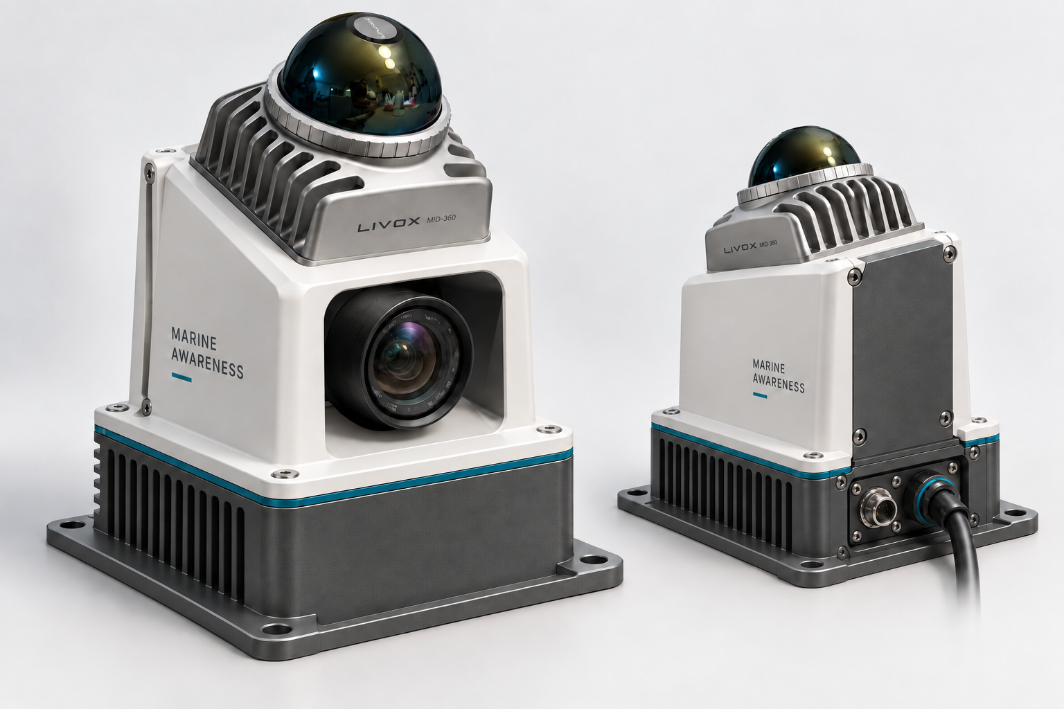
LiDAR, cameras and onboard processing bring nearby geometry and AI detections into one operator view. We are developing this capability for close-range awareness during docking and low-speed navigation on urban waterways.
NaviDepth measures and monitors the waterway. Marine Awareness adds a complementary view of the vessel’s immediate surroundings.
Distance accuracy and performance on a moving vessel still need validation.
02 / Next development
Make proximity useful
Clearance relative to the vessel’s hull
Configurable obstacle-proximity zones
Visible coverage and sensor-health states
Closing-distance trends after motion validation
Planned alerts will use obstacle geometry, with AI labels providing additional context.
03 / Integration direction
Share useful observations
Time-stamped observations and quality indicators
Selected views for onboard or remote operators
Interfaces to compatible navigation systems
Vessel-specific commissioning and validation
Remote-operation and autopilot connections are future work; no integration is claimed today.
Prototype structure
From sensor data to an operator view
InputsLiDAR + camera
Spatial measurements, images and inertial data
Onboard processingGeometry + AI
Local mapping, detections and experimental distance association
Operator interfaceView + record
Camera, point cloud, AI overlays and data for review
Current scope: a supervised perception experiment. Coverage depends on mounting and obstructions; the prototype does not command the vessel.
Potential applications to evaluate with operators
Quays & docking
Explore whether a clear view of nearby structures and future hull-clearance cues can support close manoeuvres.
Locks & narrow passages
Evaluate visibility, mounting coverage and the information an operator needs alongside walls and moored vessels.
Remote supervision
Investigate how local perception could complement existing cameras, charts and vessel telemetry.
Start with a real manoeuvre.
Bring a vessel, waterway or operator challenge. Together, we can define what to observe, what to measure and whether a supervised trial would be useful.
Standalone when that solves the job. Integrated when the mission needs more.
Remote Control KitVessel-side command, telemetry and communicationsMobile ROCPortable shore-side operator and demonstration environmentMarine AwarenessPrototype perception and recording; operator alerts in developmentSurvey ecosystemCombine selected capabilities with the platform, payload and data workflow
Reduce risk before committing to the complete system.
Start with a paid assessment, prove the selected configuration through a bounded pilot, and scale only after the technical, operational and service case is clear.
01
Paid assessment
Clarify the use case, vessel compatibility, interfaces, permissions, risks and budget range before committing to hardware.
02
Fixed-scope pilot
Validate the selected system against agreed operating conditions, KPIs and acceptance criteria.
03
System delivery & support
Deliver the accepted configuration with training, documentation, spares and an agreed annual support route.
01 · Discover
Qualify the job
Define the decision, site, vessel, operating limits, interfaces and evidence required.
Operational brief
02 · Engineer
Configure & quote
Select the platform or retrofit components, acceptance criteria and support responsibilities.
Technical proposal and budget
03 · Integrate
Build & prepare
Complete interface engineering, factory checks, documentation and regional service preparation.
Ready-to-test system
04 · Validate
Commission & pilot
Install, tune, train and run supervised field tests against the agreed acceptance plan.
Acceptance record and next step
05 · Support
Operate & scale
Maintain the system, review performance and add routes, payloads or compatible vessels.
Support and scale plan
Local-first service system
Routine support close to the customer, with specialist escalation behind it.
Customer level
Routine checks & prepared spares
Clear operator checks, documentation and replaceable items reduce unnecessary downtime.
Regional level
Local marine or electrical service
A suitable service route is appointed before operational handover for routine intervention.
Integration level
Integration & remote technical support
Remote diagnostics, interface support, software configuration and commissioning follow-up.
Specialist level
OEM and payload escalation
Factory warranty, specialist engineering and hydrographic expertise are engaged where contracted.
Project heritage
AVATAR is the foundation—not merely the name of a vessel.
The projects below are included to show where UWL's experience and development direction come from. They inform the present offer; they do not replace customer-specific assessment, validation or acceptance.
Foundational European project · Interreg North Sea Region
AVATAR created UWL's practical vessel and remote-operation foundation.
The AVATAR vessel was developed within the Interreg North Sea Region AVATAR project. UWL contributed operational know-how and real-life urban-waterway testing—including ship-to-shore and ship-to-ship steering with the Green Wave. That experience now supports further work in FOREMAST and informs the NaviDepth direction.
Builds on the AVATAR platform in Ghent to explore sustainable, small and flexible automated zero-emission vessels, connectivity, digital tools and supervised demonstrations.
Compact vessel, bathymetry and sensor-integration experience
Marine Thinking's field material demonstrates relevant survey and integration building blocks. It is shown as technology experience—not as validation of every UWL customer configuration.
Field-operation referenceVessel deployment and supervised mission support
Remote-supervision referenceMulti-source mission and data viewMarine Thinking reference environment—not a final UWL customer configuration
See the survey workflow
Field video connects the vessel, payload and customer output.
These published Marine Thinking examples demonstrate relevant survey and integration experience. Each UWL customer configuration is still assessed and validated for its own vessel, waterway and operating case.
Videos are not loaded on this page. Selecting a video opens YouTube in a new tab, where YouTube's privacy and cookie terms apply.
Choose the right first conversation
Survey-vessel opportunity or retrofit assessment?
Urban Waterway Logistics coordinates the commercial discussion and brings in the required survey, integration and service specialists as the scope becomes clear.
Survey-vessel enquiries through this page are handled by Urban Waterway Logistics. The following documents describe UWL’s data practices and its own website, and are available in Dutch.