Discuss a project
Menu

CASE STUDIES & PROJECT FOUNDATIONS

Real examples. Useful questions.

Explore published references to help describe your own needs. Supplier examples belong to the named organisations; they are not Marine RoboTech customer deliveries.

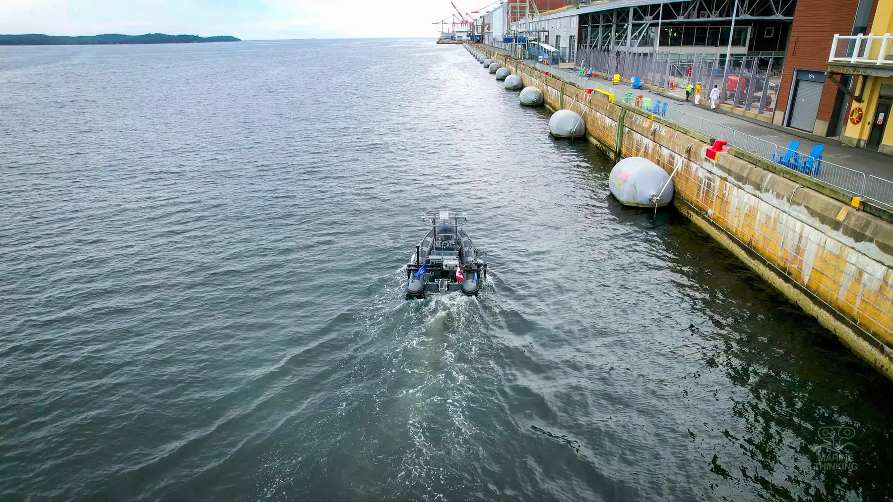
Marine Thinking Acadia operating in Halifax, a Marine Thinking field reference
MARINE THINKING FIELD REFERENCE

Marine Thinking / Halifax Port Authority

Connect the vessel and the survey workflow.

The task
Investigate the seabed beside three Halifax piers and their wharf walls.
The approach
Marine Thinking reports using Acadia, an electric survey vessel with remote control and autonomous navigation, to scan the three piers.
Documented output
Processed bathymetric data produced 3D maps showing trenches and other seabed irregularities.
Context & limitations
This is Marine Thinking’s reference. A new project needs its own configuration, availability check and acceptance criteria.
Read Marine Thinking’s case study

Watch the field video

A question for your team

Where would a repeatable survey workflow help your operation?

Discuss a similar need
NORDIC WATERS

Survey targets.
Underwater evidence.

Customer experience published by QYSEA
SUPPLIER-PUBLISHED CUSTOMER CASE

QYSEA / Nordic Maritime Group

Investigate the targets your sonar finds.

The task
Verify underwater targets before marine construction or offshore development.
The approach
QYSEA reports that Nordic Maritime Group used FIFISH E-MASTER NAVI with surface GNSS and DVL-assisted underwater navigation to investigate side-scan sonar targets.
Documented output
The operator reported a faster repeat-inspection workflow with less surface buoy marking.
Context & limitations
This is the operator’s reported experience. The account also describes cold-water reliability incidents, positioning delays and visibility limitations; performance is not guaranteed for another site.
Read QYSEA’s customer case

A question for your team

How do you investigate an object after a survey identifies it?

Discuss a similar need
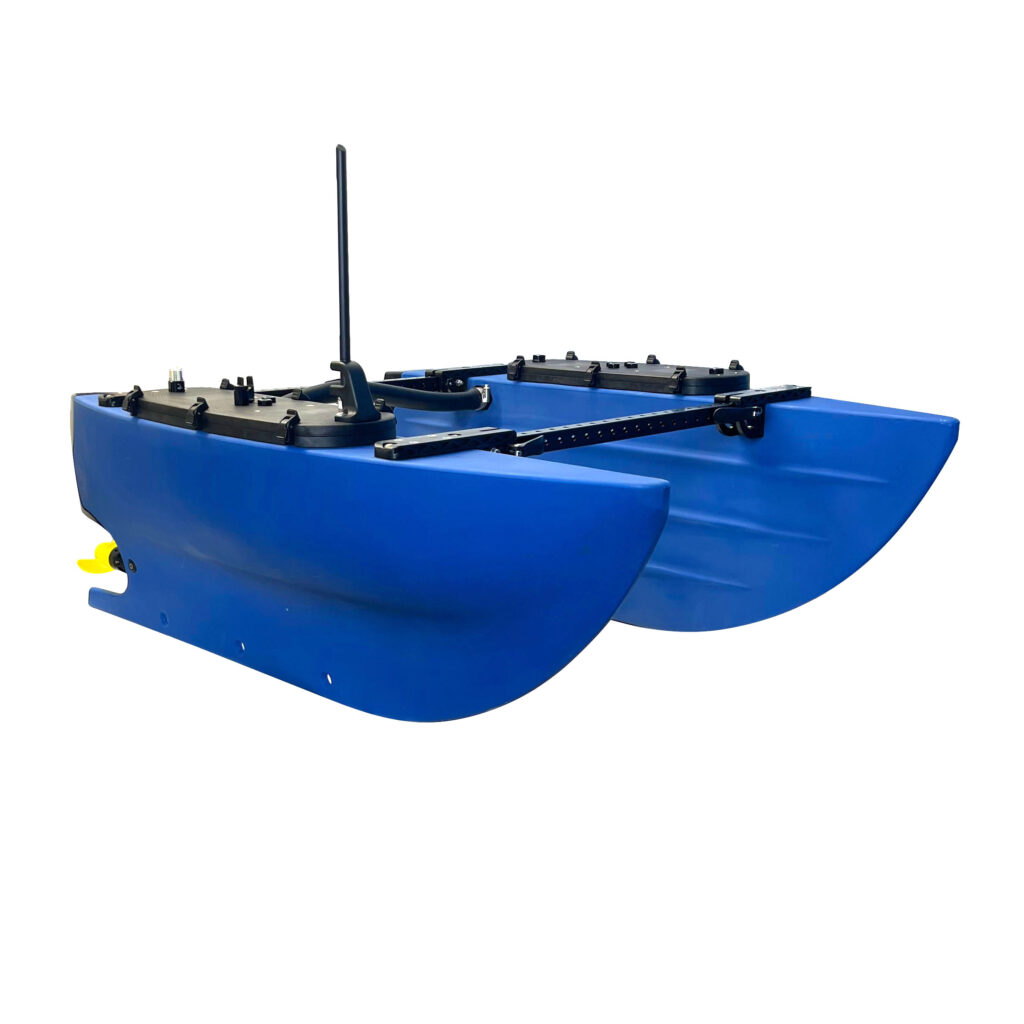
Blue Robotics BlueBoat, the platform discussed in the manufacturer guide
MANUFACTURER PRACTICAL GUIDE

Blue Robotics / BlueBoat + Ping2

Turn depth measurements into a map.

The task
Collect basic depth information and turn it into a usable visual output.
The approach
Blue Robotics documents a BlueBoat and Ping2 workflow: log depth readings, filter the data and create a bathymetric map in QGIS.
Documented output
The guide shows the path from recorded measurements to a reviewed map.
Context & limitations
This is an instructional example, not evidence of compliance with a customer's hydrographic survey specification. Accuracy and coverage require a suitable configuration and validation.
Read the Blue Robotics guide

A question for your team

What decision would better depth information help your team make?

Discuss a similar need
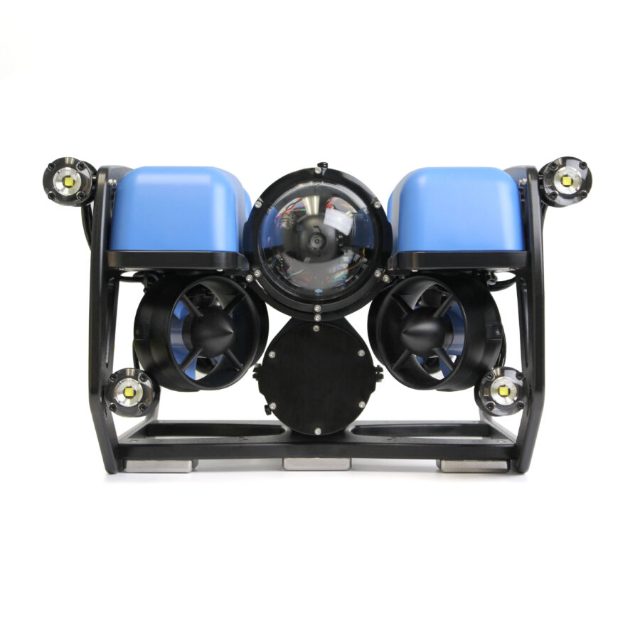
Blue Robotics BlueROV2 product image; not a photograph of the referenced inspection
MANUFACTURER FIELD EXAMPLE

Blue Robotics / BlueROV2

Look closely at submerged equipment.

The task
Check submerged aquaculture anchors and cages.
The approach
Blue Robotics describes using BlueROV2 at two fish farms in Ensenada, Mexico, to inspect anchors and the inside of cages.
Documented output
The manufacturer reports finding issues with several anchors and provides field video.
Context & limitations
This historical example illustrates visual inspection. Evidence quality depends on access, water conditions and the inspection method.
View Blue Robotics’ field example

A question for your team

Which submerged assets are difficult for your team to check today?

Discuss a similar need

PROJECT EXPERIENCE & DEVELOPMENT

Waterway surveys and onboard awareness.

Urban Waterway Logistics (UWL) leads the NaviDepth survey-vessel initiative. Marine RoboTech develops the Marine Awareness sensing prototype. Explore the experience behind these areas and the testing needed before a vessel pilot.

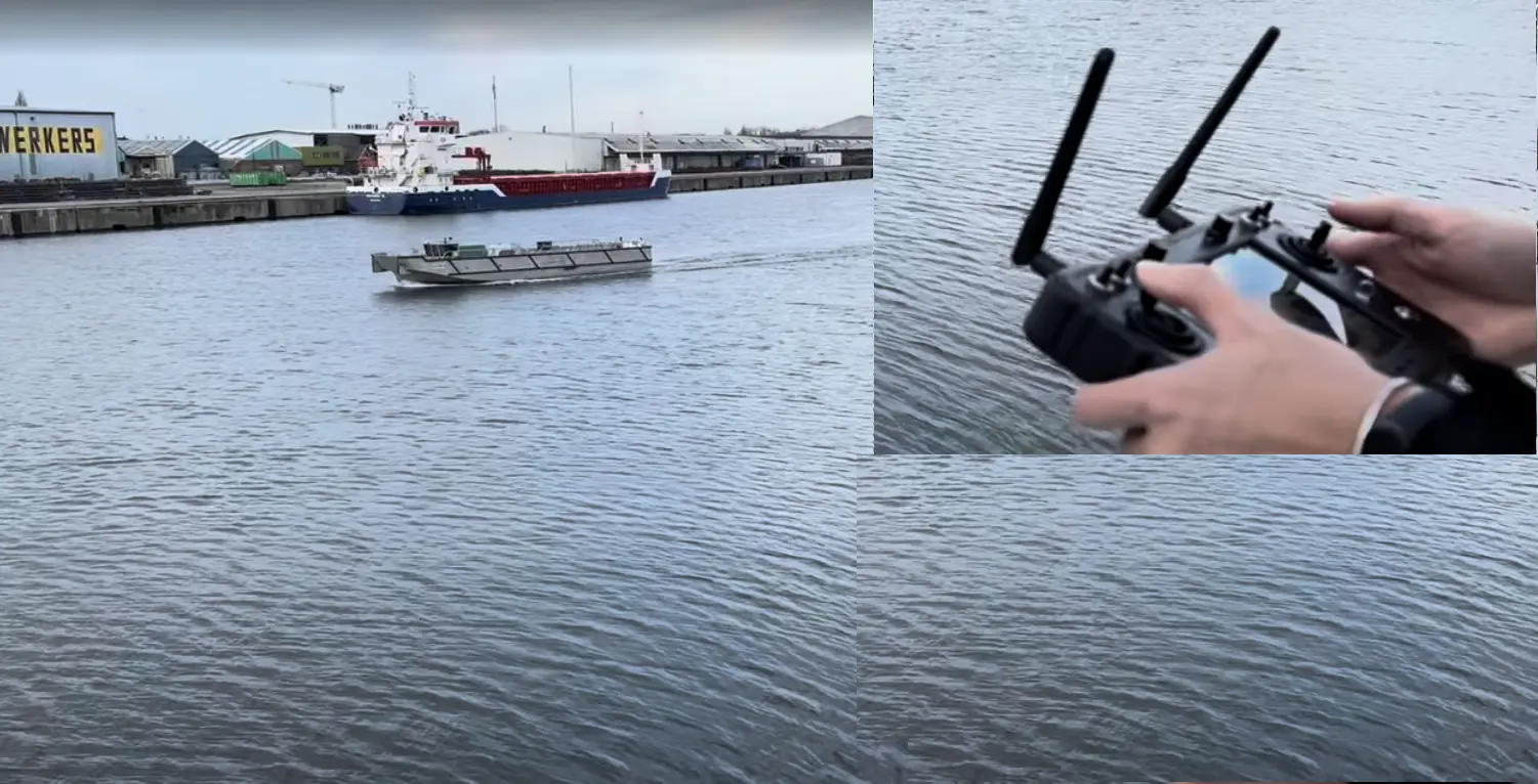
AVATAR vessel and handheld remote controller
UWL / VESSEL & REMOTE-OPERATION EXPERIENCE

European waterway experience

Experience with AVATAR vessels and remote operation informs NaviDepth’s proposed survey and monitoring approach. UWL provides the vessel-application context and coordinates discussions about European pilot opportunities.

Explore vessel experience and project scope
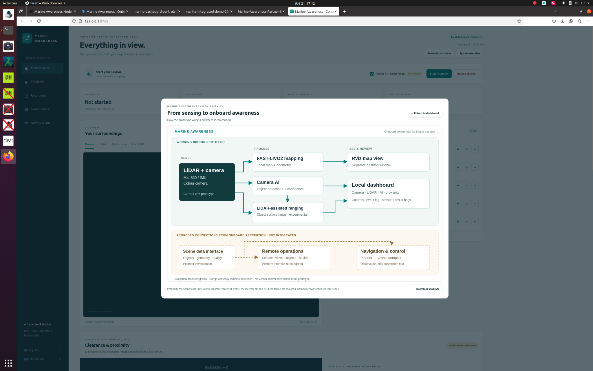
Marine Awareness prototype dashboard captured during indoor testing
MARINE AWARENESS / INDOOR PROTOTYPE

Marine Awareness

The prototype combines camera images, LiDAR measurements and AI detections to help operators interpret nearby objects and surfaces. These views have been demonstrated indoors; vessel trials and marine performance validation remain next steps.

See the prototype evidence

Does an example resemble your challenge?

Share the task, how you handle it today and the result you need. We can help turn that into a practical requirements discussion.

Discuss your application